The west of the story: random scenery interlude

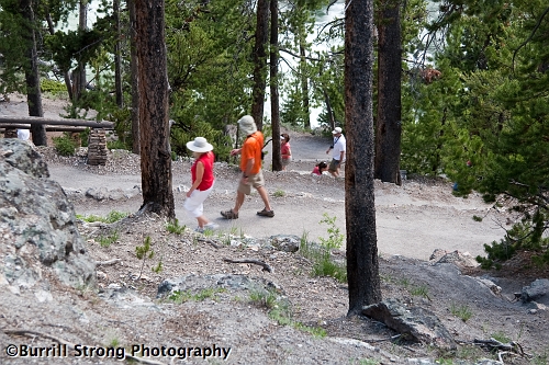
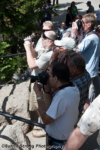
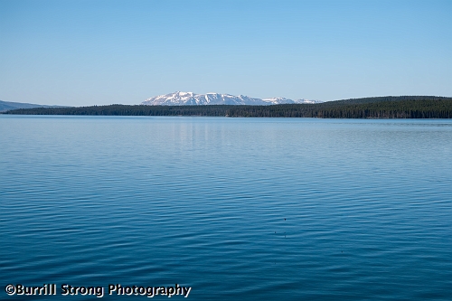
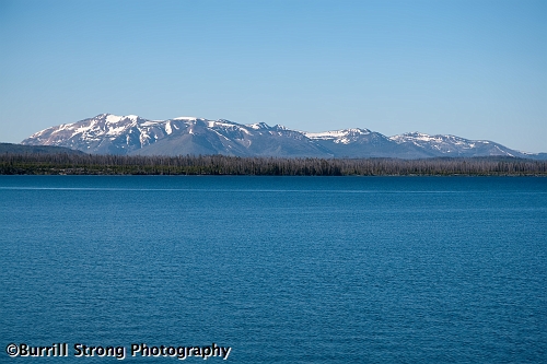
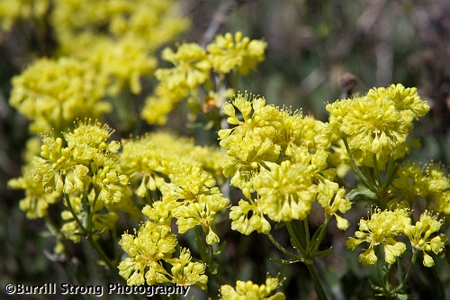
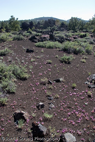
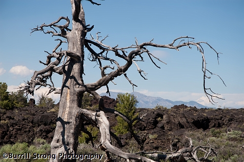
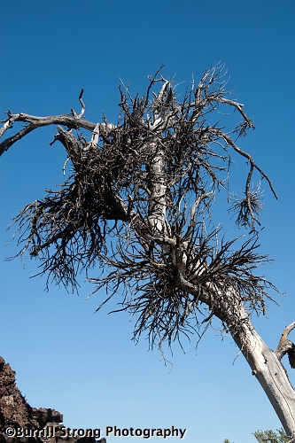
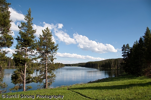
Since Yellowstone is a huge park, it takes a lot of driving to see the sights.  That’s not such a bad thing, though, because while you’re driving to the next notable feature, you’re surrounded by an endless array of notable scenery.  Also, you’re surrounded by an endless supply of turnoffs intended to let you enjoy the scenery at zero miles per hour.  Our mid-afternoon travels took us alongside Yellowstone River, a broad river winding through a lush green valley that was eye-catching enough to cause us to stop the car twice to enjoy the view.

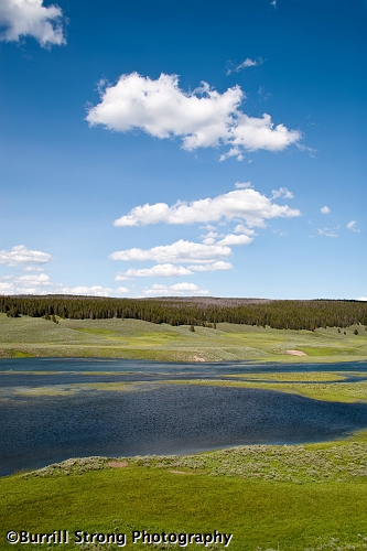
Our first stop was at a turnoff farther back and up the hill from the river; from there, we got a splendid view of one of the more serene and welcoming areas of the park.  I’d be happy to live there, except I wouldn’t want to ruin it by living there.  (That’s how I wish more people would view small towns.  Hey, folks: if you all move into a small town to live the small-town life, it’s no longer a small town.  Think about it.)

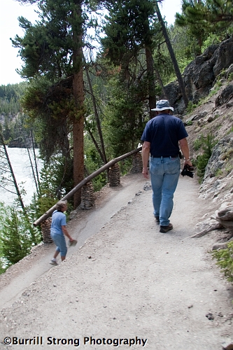
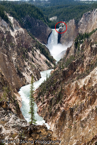
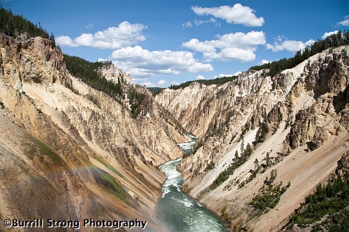
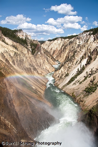
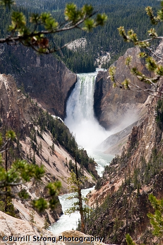
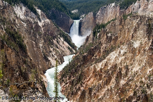
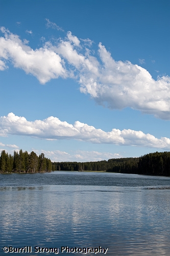
Not far down the road, we stopped at another turnoff that provided a view of what looked like an entirely different river from the one that seemed to be wandering haphazardly through a meadow.  (A few miles downstream, the Yellowstone River plummets over the two majestic waterfalls of the Grand Canyon of Yellowstone.  That water has no idea of the thrill ride that awaits it.)

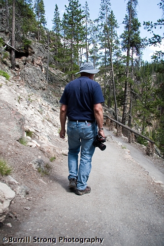
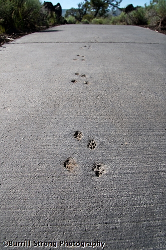
If you look closely, you may notice a curious dark line angling through the grass towards the river.  That’s a path where the grass has been worn away.  In my infinitely sensible wisdom, I assumed that path was something created by official park human ranger people for use by official park human tourist people, so I took full advantage of that very thoughtful amenity.  It was unexpectedly narrow — at best, barely as wide as my two feet — but it led me right down to the river’s edge, where the view was even better.

When I got back to the car, I realized the path in the grass wasn’t there for use by park visitors; rather, it was a path created by park wildlife, much like the deer trails I’ve seen here in Michigan.  It was at that moment I realized no matter how hard you try to avoid being one of those tourists, at some point during your visit you will be one of those tourists.  It’s inevitable: when you choose to don the mantle of tourist, you are doomed to be a complete idiot one time.  That, I think, should be the First Law of Tourism.  I’m just glad my unavoidable moment of idiocy was fairly benign and not life-threatening.

The west of the story: don’t overlook the overlook

Having ogled the Other Grand Canyon by way of two very easily-accessible ground-level overlooks, we decided it was time to end the laziness and tackle a reasonably strenuous challenge.  We chose what sounded like the most promising (and thrillingly-named) destination within my range: the Brink of the Lower Falls.

While the path to the Brink isn’t a particularly long trail, it’s also not the easiest trail.  It works its way down the canyon wall by working its way back and forth through 180-degree turns, sort of like San Francisco’s famous Lombard Street, but narrower.  Here you can see four different legs of the path.

The path is narrow, and while it’s mostly smooth, it does have its imperfections.  Also, as the above photo shows, aside from the handrails at the turns, there are no fences or handrails to prevent an unfortunate visitor from accidentally taking a painful shortcut to the bottom.  (The good news is that there is a fence at the bottom to prevent that unfortunate visitor from accidentally taking a refreshing swim at the end of his painful shortcut.)  I doubt most visitors worry much about the open edges, but as I walked down the trail, my questionable balance and propensity for stumbling prompted me to be unusually cautious — especially when oncoming traffic had the inside of the path, forcing me to walk near the edge.

The canyon wall around the path holds fine examples of plants adapting to grow in difficult places; for example, because of the steep incline and the intrusively supportive rock, this particular tree is sponsored by the letter J.

The walk to the bottom of the path took me about 15 minutes, but as I noted, I sacrificed speed for caution; if you’re not entirely out of shape and you trust your balance, you could make it in 10 minutes.  (I’m sure you could make it in even less time, but there’s no real reason to hurry.  It’s a fun trail; just enjoy it.)  When we reached the end, we found that the overlook’s name wasn’t exaggerating: it truly does let you stand at the brink of the falls.  To illustrate its crazy location, here’s a photo of the lower falls from Artist Point; the Brink overlook is circled in red.

The path to the Brink provides little in the way of canyon views, so there’s really no clue to what awaits at the end of the path.  That’s good, because when you’re finally presented with the view from the Brink, the impact is incredible.  I’ve been blessed enough to have seen beautiful sights across the United States and even in Europe, and I can say the view from the Brink of the Lower Falls is, without a doubt, among the most beautiful I’ve had the privilege of seeing.  That was my first thought when I reached the end of the path and saw the canyon bathed in sunlight and capped by a gorgeous summer sky, and even now, a year later, it’s still my thought when I see the photos of the canyon from the Brink.  I can’t fully elucidate the qualities that pin the scene at or near the top of the list, but I know it’s there.

What makes the whole scene even more remarkable is the adjacent presence of the waterfall.  There’s no optical illusion or misleading angle in the above red-circly photo; the overlook lets you stand at the edge of the cliff right next to the river, with only a fence separating you from a refreshing swim of certain death.  So while I was showing my shocked face to the canyon, I was listening to the thunderous roar of endless gallons of water pouring over the cliff and crashing onto the rocks below.  It’s one thing to admire a waterfall from afar, but it’s something else entirely to get an up close and personal experience of the power of a waterfall.

So: enough jabbering.  Here’s the view.

Those pictures don’t even have the phone number of doing the canyon view justice, but they’re enough to provide an idea of the stunning panorama that awaits.  If you ever visit Yellowstone — and you should, post-haste — and you’re wondering what to visit on a beautiful sunny afternoon, go to the Grand Canyon of Yellowstone and walk the trail to the Brink of the Lower Falls.  It’s one of the highlightiest highlights of the park.

The west of the story: canyon dig it?

Among the many features of Yellowstone, a few stood out to us as the best to visit in our (sadly) limited time in the park; it should come as no surprise that one of those was the ambitiously-named Grand Canyon of the Yellowstone, a marvelous hole in the ground with two waterfalls and plenty of spectacular views.  After getting our first look from the easily-accessible Upper Falls Viewpoint, we proceeded farther down the canyon to Artist Point, a popular overlook that provides a superb view of the lower falls framed by the canyon walls.

Artists Point stretches out into the canyon, but the remarkable views begin early on the walkway to the end of the point.  Of course, not knowing how far the path continued and how much more open the views would get, I took the first chance I got to grab a photo of the scenery; the above photo is the result of that impatience.  But, as I soon discovered, I wasn’t the only one to shoot without first exploring.

After spending a few moments observing the throng of camera-bearing tourists, we moved on to the actual point of Artist Point.  The views of the upper falls from the point itself weren’t remarkably different from those of the misguidedly popular roiling mass magnet, but since the point of the Point is actually in the canyon and beyond most of the obstructive trees, the views of the canyon as a whole are worth the short (and very easy) walk.

The west of the story: they’re so hot right now

Most of Yellowstone bears a generally neutral outdoor smell, but the sulphur in the park’s thermal features provides a more pungent odor for tourists to enjoy in those relatively small areas.  And, as anybody who’s lived in a house with well water can attest, the odor isn’t all the sulphur contributes to the park: just as it stains carpets and toilets, it also stains rock.  But unlike those generally unpopular carpet and toilet stains, the stains on Yellowstone’s rock are gorgeous.

Of course, those stains need more than just intermittent bursts of water from the most spectacular geyser eruptions to form; the colorful compositions pictured above were caused by the more consistent flow of hot water from a variety of less dramatic holes in the ground.

Sternly-worded warning signs are a frequent and prominent feature throughout the park, and for good reason: for the flocks of tourists who might not know what common sense means outside an urban setting, the unrestrained natural world can be dangerous.  This sad truth is newly illustrated each year by careless or foolhardy visitors who venture off the established boardwalks and trails and fall into the park’s thermal features; some escape with severe burns, but others aren’t so fortunate: 20 visitors have died from encounters with the thermal features.  If you imagine jumping into a huge pot of boiling water on a huge stove, you have a good idea of what it would be like to fall into one of the park’s thermal features — and, I hope, you have an even better idea of why the warning signs aren’t paranoid suggestions.  In many cases, the water actually is visibly boiling.

As we were examining the curious features, one Hispanic visitor — who apparently didn’t think much of the warning signs — felt compelled to see if the water really was as hot as it looked.  The water exiting the spring in the above photo ran within arm’s reach as it traveled under the boardwalk, so he knelt down on the boardwalk and reached his hand out toward the water.  The moment his finger touched the water, he immediately jerked his hand back and exclaimed, “Muy caliente!”

Before I could muster the necessary amount of disdain to laugh at his obvious lack of common sense, he made another decision that prompted me to put my camera to my eye.  After he made sure the tip of his finger was still there, he eagerly gestured to his wife to test the water, just as he had done.  A thoroughly sensible woman might have pointed to his reaction as a fine reason not to follow his example; instead, as a relative aimed her camera to record the moment, she knelt down on the boardwalk and reached toward the same scalding water.

To my relief, her arm was a bit shorter than her husband’s, and she wasn’t nearly as committed to the idea as he had been.  She posed for a photo as shown above, but she elected not to make the extra effort necessary to reach the water.

(Just a note: though I made an effort to detail some of the park’s dangers, it’s not my intention to make this post an unpleasant representation of the Yellowstone experience.  The park is a stunning and highly accessible display of some of earth’s more grandiose and bizarre features, and I believe it’s one of the places everybody should make an effort to visit.  But from both the tone of the warning signs and the numerous stories of behavior that ranges from foolhardy to fatal, it’s apparent that far too many visitors aren’t inclined to take seriously the very real dangers of the world outside our controlled civilization.  If you are able to make a visit to Yellowstone, see as much as you can and have a great time…but please, pay attention to the warning signs, treat the park’s features with a healthy respect, and exercise intelligent restraint and common sense.  Yellowstone isn’t an amusement park; it’s the real world.)

The west of the story: beehive yourself!

When Old Faithful went back to its oft-interrupted nap, we walked over to the nearby visitors center to see what it had to offer.  But not long after we began perusing its various displays, we were interrupted by a park ranger’s announcement: the Beehive geyser was about to erupt.  We were unfamiliar with this particular geyser, but the ranger made it clear this was an event not to be missed, so we joined the mass exodus from the visitors center.

Much like Old Faithful, we saw only minor hissing and sputtering for a few minutes.  But before too long, the Beehive escalated to full strength, and we quickly decided the ranger wasn’t exaggerating its total awesomeness.

It’s hard to get a sense of the remarkable height of the Beehive in that photo, so here’s a photo that gives a bit of scale.

For those of you who like real numbers that signify real measurements and other absolute things: the Beehive eruption lasts for about five minutes and reaches heights of 200 feet.  (For comparison, Old Faithful’s eruptions can last anywhere from 1.5 to 5 minutes and rise anywhere from 90 to 184 feet.)  So if you stood a regulation NHL rink on end, it would be like a frozen Beehive geyser.  Well, it would be flat and smooth, it would look hilariously out of place and it would be ridiculously difficult to use for hockey, but it would be as tall as a Beehive eruption.

The Beehive gains both its height and its name from the cone through which the water is propelled into the air.

As one might expect, that much water being herded through that small an opening with enough force to push it 200 feet into the air produces a lot of noise.  The loud rumble isn’t get-the-earplugs noise, but it can be raise-your-voice noise.

We were fortunate enough to be there on a fairly calm day, but there was still just enough of a breeze to send the water across the boardwalk.  We thought we were being smart by observing the Beehive from a bit of a distance to stay dry, but as it turned out, we weren’t quite smart enough; as the geyser raged, the breeze shifted and sent the water directly at us.  We didn’t get anywhere near as wet as the adventurous tourists in the above picture, but we certainly didn’t stay dry.

The west of the story: eruption junction, what’s your function?

Our first destination in Yellowstone was its most famous feature, Old Faithful.  It’s one of those features everybody visits, but there’s a good reason for that: it’s awesome!  I mean, come on: it’s boiling hot water shooting into the air on a fairly regular schedule — hence the name — and it happens without any human influence.  It’s not just weird; it’s naturally weird.

When we arrived at Old Faithful, it looked more old than faithful.  It was sleeping peacefully, with only a few calm steam clouds providing a clue to the location of the giant hot tub jet in the ground.

While we waited for Old Faithful to wake up, we enjoyed watching the crowd wait patiently for the show.  While modern Americans are known for anything but patience, the hundreds of people gathered around the geyser waited quietly for about 15 minutes while Old Faithful napped.  I have no idea why a geyser could compel people to wait 15 minutes when they’d normally get impatient after 15 seconds at a red light, but it was hilarious.

Eventually, Old Faithful began to hiss and gurgle, providing a prelude to its performance. It started off small…

…But it didn’t stay that way.

After hanging out with us tourists for a couple minutes, Old Faithful quieted back down and went back to producing clouds of steam.

When the eruption ended, we all agreed: Old Faithful was well worth the visit and the wait.  It’s not just that it’s a curiously fascinating natural feature — which it is — but it’s also an iconic American destination.  It’s not just a geyser; it’s Old Faithful.

The west of the story: Psalm 19:1 isn’t kidding

When we departed Craters of the Moon, we headed for the penultimate major feature of our trip: the famous Yellowstone National Park.  Our time at Craters pushed back our schedule enough that we arrived at Yellowstone after dark, so we drove to our cabin in the middle of the park without being able to appreciate the scenery because, you know, we couldn’t really see it.  That was probably good, though, as I’m not sure we would have fully appreciated it at that point: not only were we worn out from a day of National Parking and driving, but we were also somewhat exasperated because our GPS tried to lead us down a road that didn’t exist.  It told us to turn left, but we couldn’t figure out where to turn because all we saw was a rather abrupt slope that led directly into Lake Yellowstone, which definitely isn’t a road.  After a few minutes of confusion we did manage to find the road we needed, and before long we stumbled into our cabin quite ready not to be awake.

(We did investigate the curious discrepancy the next day, and we discovered the GPS wasn’t trying to kill us; rather, it was just out of date.  There used to be a road where it kept telling us to turn, but it had been closed.)

When we began exploring the park under a brilliant blue sky the next day, we saw what we’d been missing during our late-night drive.  Essentially, we’d been missing one of the most beautiful places on earth.  Not far from the irksome non-existent road was this emphatically non-irksome Lake Yellowstone view that prompted us to stop the car so we could let our jaws drop without causing an accident:

Actually, we made two or three brief stops to ogle the lake and its surroundings, but we did move on without much delay.  And if you come back for the next post, you’ll see where we ended up next.  (I’d include the next destination in this post, but like nearly everything we saw in Yellowstone, it deserves its own post.)

The west of the story: the devil’s in the orchard’s details

Our next stop in Craters of the Moon was the far less windy Devil’s Orchard, a curious landscape which gained its name from a visiting minister who declared the collection of jagged lava formations and weather-beaten trees to be a garden fit for the devil himself.

The Devil’s Orchard trail is neither strenuous nor lengthy; it’s entirely flat and paved, and it’s only half a mile, which is short enough for even the laziest tourists.  And the Orchard even has a little something to offer to those who prefer some color in their scenery!

If you thought I was kidding about the Orchard having a little something to offer, I wasn’t.  Those purple flowers are very common, but they’re not overwhelming because they’re little.

Remember the Inferno Cone Overlook?  It’s not too far away from the Orchard.  In fact, you can see the hill and its lone tree at the top of this photo:

There are live trees in the Orchard, but unsurprisingly, they’re far less fascinating than the incomparable natural sculptures of long-dead trees that dot the landscape.  The dead trees are like modern art, except they’re actually aesthetically appealing.

Though the weather-beaten forms are appealing enough on their own, a number of the trees are even more eye-catching thanks to Witch’s Broom, a bizarre disease that causes dense growths of branches.

Near the end of my walk through the Devil’s Orchard, I came across a reminder of the presence of wildlife in the park.  One particular animal, defiantly ignoring the “wet cement” signs, took a stroll on the path before it dried.

The west of the story: inferno, but not disco

Though we may have wished otherwise, we had to start driving back east sooner or later.  But that wasn’t all bad: on our way out of Idaho, we just so happened — by which I mean planned — to make a stop at the bizarre and awe-inspiring Craters of the Moon National Park in eastern Idaho.  That may seem like an odd name for a decidedly terrestrial park, but it’s quite apt: long ago, generous amounts of lava covered the landscape, leaving it looking a little like some of Hawaii’s jagged lava-covered areas, but without the Hawaii.  It’s impossible to miss the park’s boundaries, as there’s an abrupt change from the typical Idaho landscape to the park’s hard black lava crust.

After a brief stop at the visitor’s center, we moved on to our first destination: the frighteningly-named Inferno Cone Overlook.

The Overlook isn’t nearly as scary as it sounds; rather, it’s simply a large hill that provides a fine overview of the park.  The climb is a little strenuous, but it’s worth the effort.  But, of course, before I undertook the climb, I took a few pictures of the Overlook and its surroundings.

Though the Overlook appears barren, the park’s landscape isn’t entirely devoid of vegetation.  But generally, where there aren’t small trees or various scrubs, there’s lava.

With the initial photos out of the way, we started up the hill.

When we reached the top of the slope, we were assaulted by a brutal, unrelenting wind.  This wasn’t your standard tousle-your-hair-wind; this was a wind strong enough to knock me over if I didn’t concentrate on just standing up.  However, a few of our fellow tourists took advantage of the wind.

When we recovered from the initial blast of wind, we noticed the top of the hill looked as barren as the slope…

…But further exploration revealed some hardy vegetation that stubbornly defied the harsh conditions.

And remarkably, though the tree grave pictured above looks ominous, one tree managed to stand tall on the hilltop.  Its exposed roots make it appear to be hanging on by its fingernails, but despite the wind’s best efforts, it wasn’t going anywhere.

But on the whole, those patches of green were definite exceptions.

The west of the story: KABOOM!

As every American knows, the Fourth of July goes by another name: National Entertaining Explosions Day.  (Oh, and it’s called Independence Day, too.)  Since our visit to Idaho happened to include our nation’s most gunpowdery holiday, we were happy to discover the local municipality celebrated the holiday with gusto — in fact, it boasted one of the largest fireworks displays in the state.  Even better, southwestern Idaho’s generally flat open landscape afforded us the luxury of avoiding crowds and traffic by enjoying the fireworks from several miles away.